A coastal limestone formation on New Zealand''s West Coast where marine sediments compressed into alternating hard and soft strata have been eroded by the Tasman Sea into distinctive layered stacks — with blowholes that send geysers of seawater skyward during high tide and heavy swell.
The Punakaiki region of New Zealand''s West Coast receives some of the highest rainfall in the country — up to 5,000 millimeters per year — driven by the prevailing westerly winds that cross the Tasman Sea. Those winds also drive the Tasman swell: long, powerful ocean waves that arrive from the south and southwest with no significant land to interrupt them before New Zealand.
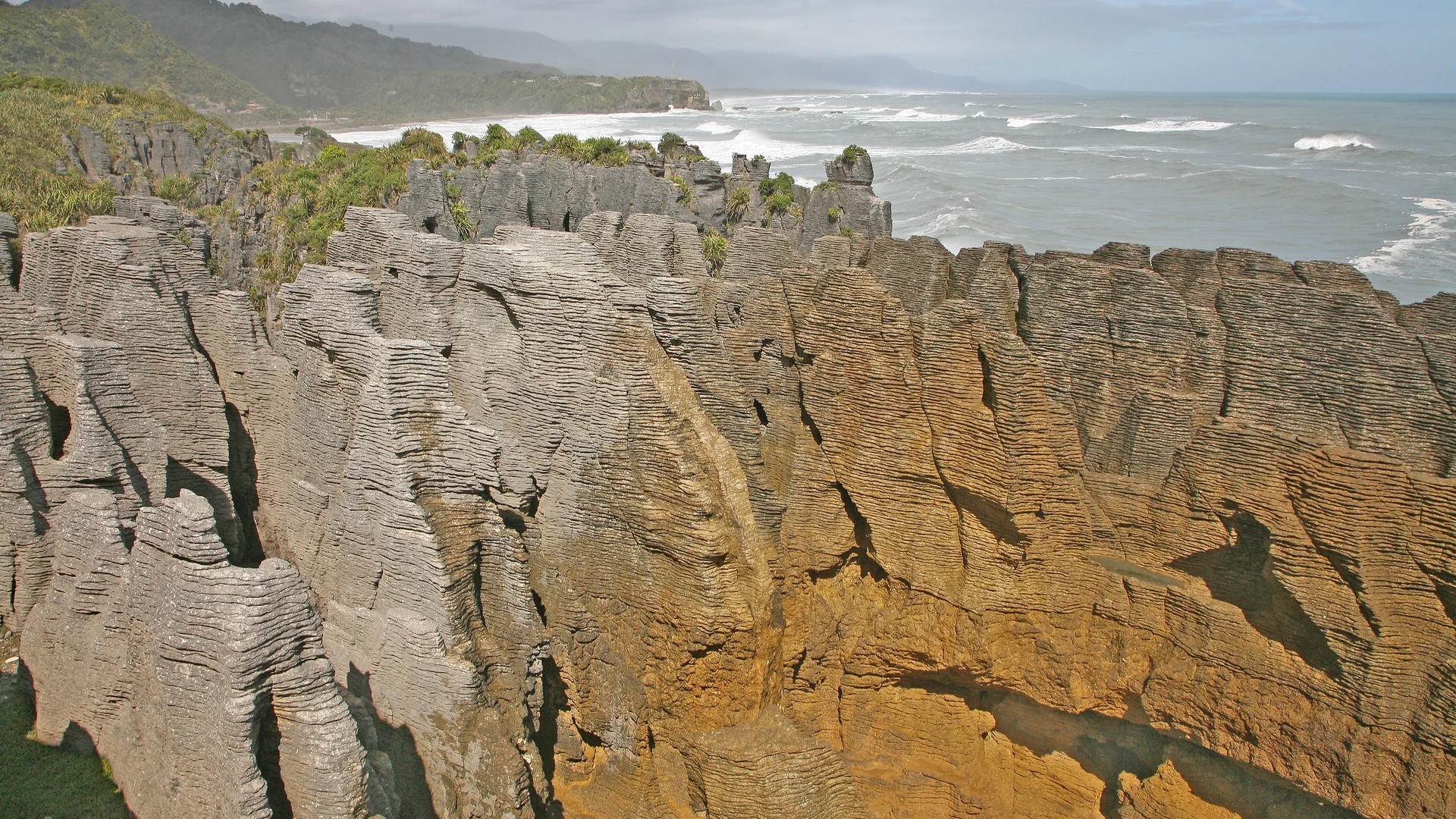
Thirty million years ago, this area was a shallow sea. Dead marine organisms — shells, coral, sea creatures — accumulated on the seafloor in layers. Over time, these sediments compacted into limestone. But not uniformly. The layers alternated between dense, hard limestone and softer, more porous material. The difference in hardness between alternating layers is significant.
When the Tasman Sea erodes this layered limestone, it removes the soft layers faster than the hard ones. The result is horizontal platforms of hard limestone separated by horizontal gaps where the soft material has been removed — the stacked, level forms that give the site its name. Each pancake corresponds to a distinct period of ancient ocean conditions.
The blowholes are channels that cut through the rock, connecting the sea caves beneath the formations to openings at the top. When large swells compress into the caves, the pressure forces water through these channels and up through the surface. At high tide during large Tasman swells, the geysers reach five to ten meters. The timing is unpredictable; the effect is loud.
The site is a 20-minute walk from the road on a well-maintained path. This accessibility has not diminished it. The scale of the formations, the noise of the Tasman, and the unexpectedness of the blowholes produce something that cannot be adequately prepared for.