A 348-meter sandstone monolith rising from the flat Australian desert — the exposed tip of a vast rock formation extending kilometers underground — sacred to the Aṉangu people for tens of thousands of years, and one of the most recognizable geological forms on Earth.
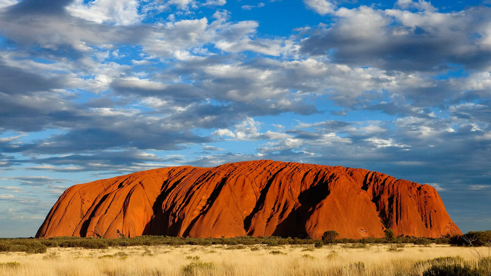
What you see is the tip. Uluru rises 348 meters above the surrounding desert plain, but the formation extends 2.5 kilometers underground. It is not a hill. It is the end of a vast tilted arkose sandstone slab — the Mutijulu Arkose, deposited as sediment on an ancient seafloor 550 million years ago, buried, compressed into rock, tilted nearly vertical by tectonic forces, and then exposed over hundreds of millions of years as everything above it eroded away.
The color changes with the light and the time of day in ways that are difficult to photograph accurately. At sunrise, Uluru glows orange and then red as the sun comes over the flat horizon and strikes the iron-oxide-rich surface. At sunset, the sequence runs in reverse — red deepening to maroon and then dark purple as the light fails. After rare desert rain, the entire rock turns dark grey, water streaming down its curved flanks, pooling in the waterholes at its base.
The Aṉangu people have lived in relationship with Uluru for at least 30,000 years. The rock is Tjukurpa — law and spiritual foundation and creation narrative simultaneously. Specific sections of the rock''s surface record specific events in the creation stories: a cave for one ancestor, a waterhole for another.
Climbing Uluru was possible for most of the 20th century. The Aṉangu asked visitors not to climb — the path ascended a route sacred to their Mala men, and deaths on the climb caused them cultural anguish they are not permitted to discuss publicly. Climbing was permanently prohibited in October 2019.
To walk around the base — the full circuit is 10.6 kilometers — is to understand something about scale and continuity that the view from a distance does not offer.