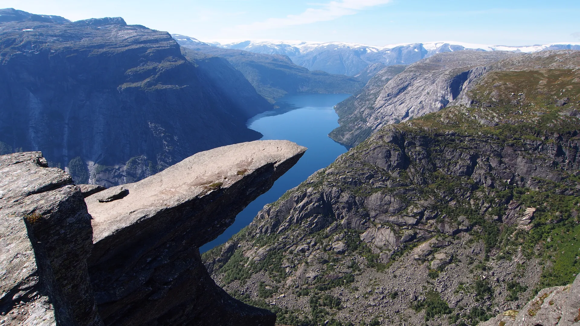
A blade of Precambrian rock projects horizontally from a Norwegian cliff face, hanging 700 metres above Lake Ringedalsvatnet in a pose that defies the visual logic of geology.
The rock is approximately one billion years old. It has been in this position — projecting horizontally from the cliff face above Skjeggedal, overhanging Lake Ringedalsvatnet 700 metres below — for about ten thousand years, since the last glacier retreated and left it exposed. The ice carved and polished it and then departed. The rock stayed.
Trolltunga — Troll''s Tongue — is 10 to 15 metres long, extending straight out from the cliff edge, roughly horizontal, with nothing below for the length of two Eiffel Towers. It was formed by horizontal fractures in the ancient Precambrian gneiss, combined with the scouring action of glacial ice that removed the supporting rock below. What remains is a geological cantilever that has somehow persisted through ten millennia of Norwegian freeze-thaw cycles.
The hike to reach it is 28 kilometres round trip, with an elevation gain of approximately 1,000 metres. Most hikers start at 4 AM to complete it in daylight. In summer, at the peak of the Norwegian tourist season, queues to stand at the tip can reach two hours long. In winter, the route requires crampons, ice axes, and mountaineering experience. People have died here.
Those who reach it face the same decision: step to the edge. What lies beyond is 700 metres of clean Norwegian air, a lake that looks like a map of itself, and a view that makes explicit how high up you are in a way that no photograph has ever successfully communicated.
Interesting facts
What does "Trolltunga" actually mean?
Troll's Tongue. In Norwegian folklore, trolls are ancient, massive creatures associated with mountains and stone — beings that turn to rock when caught by sunlight. The name was given informally, not officially, sometime in the 20th century, and describes exactly what the formation looks like from a distance: a thick stone tongue protruding from the cliff face, frozen mid-extension. Before the name stuck, the rock had no particular designation. It was just a geological accident that locals knew about.
What time of year is it actually accessible?
The trail is officially open from late June through mid-September. Outside those months, snow and ice make the route dangerous without mountaineering gear, and several fatalities have occurred on winter attempts. In July and August, the plateau can be crowded and queues at the rock itself are common. The most striking conditions — empty trail, dramatic light, possible snow on surrounding peaks — occur at the edges of the season, in late June or early September, when the weather is unpredictable but the place is closer to what it actually is.
Was Trolltunga always a famous destination?
Until the early 2010s, almost no one outside the local area had heard of it. Then a single widely-shared photograph — a person standing alone at the edge above the lake — spread across social media and transformed a remote geological feature into one of Norway's most visited sites. Visitor numbers went from a few hundred per year to over 80,000 annually within a decade. The rock itself has not changed. What changed was a photograph.
How hard is the hike to get there?
The round trip is 28 kilometres with roughly 1,000 metres of elevation gain. Most hikers start at 4 AM to make it back before dark. At peak summer, the trail sees hundreds of people per day — and queues to stand at the tip can reach two hours. In winter, the same route requires crampons, ice axes, and proper mountaineering experience; several people have died attempting it in icy conditions. The view from the top is extraordinary. The hike is not casual.
How far does the rock actually stick out — and what is below it?
Trolltunga extends 10 to 15 metres horizontally from the cliff face. Below it is 700 metres of open air — approximately twice the height of the Eiffel Tower — and then Lake Ringedalsvatnet, which from the tip looks less like a lake and more like a flat blue map of itself. The drop is one of the cleanest vertical exposures in Scandinavia: no ledges, no slope, just cliff and then water. No photograph taken from the rock has ever fully communicated what 700 metres of nothing beneath your feet actually feels like.
How old is this rock, and why hasn't it fallen?
The rock is approximately one billion years old — Precambrian gneiss, some of the oldest exposed stone in Norway. It has been cantilevering over the lake for roughly ten thousand years, since the last glacier retreated and left it unsupported. What keeps it in place is the same horizontal fracturing in the rock that shaped it: the break lines run parallel to the cliff, not through it. There is no crack propagating toward failure — at least not one that has been found. Whether it will stand for another ten thousand years or collapse tomorrow is genuinely unknown.
Safety information
Safety information is not available yet.
Before visiting this place, check current safety guidance, access rules, local restrictions, and official updates on other trusted websites. Our editorial team does not have verified safety information for this location at the moment; it will appear here later.