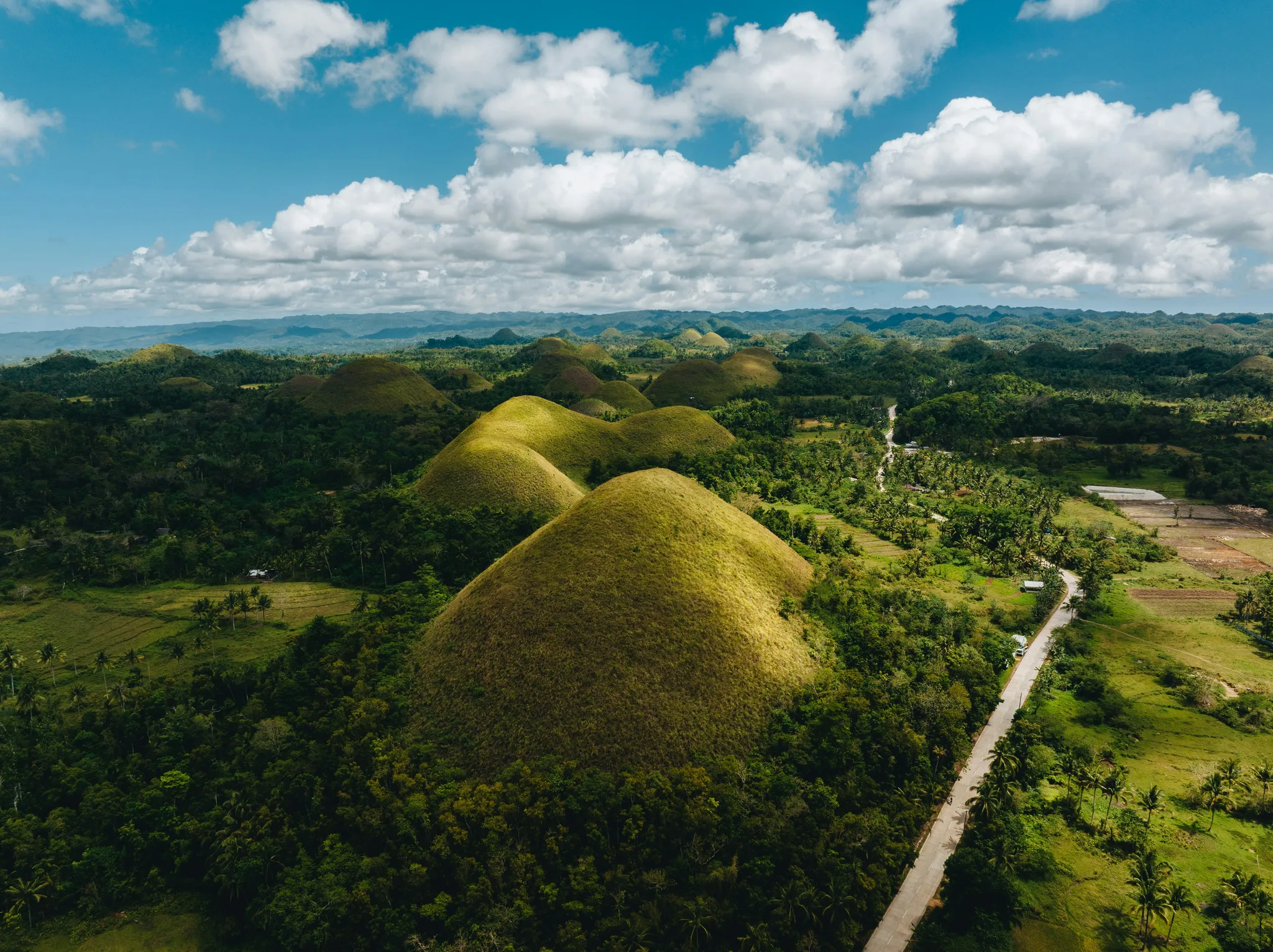
More than 1,200 almost perfectly cone-shaped grass-covered limestone hills spread across 50 km² of Bohol Island, turning chocolate brown in the dry season — their unusual geometric uniformity has no fully accepted geological explanation.
Bohol Province officially counts 1,268 hills. Other surveys have found more. What no one disputes is the form: each hill is nearly identical to the others — a rounded cone of symmetrical geometry, 30 to 50 meters tall, rising from the flat agricultural valley floor, covered in coarse cogon grass that turns chocolate brown during the dry season from December through May. From any elevated point on Bohol, in dry season, the landscape extends to the horizon in every visible direction as a repetition of identical brown cones. From the viewing platforms constructed above the main concentration near the town of Carmen, the repetition becomes difficult for the brain to process as natural, because the scale and regularity suggest manufacture rather than geology.
The Chocolate Hills are karst. The underlying rock is marine limestone — a coral reef system that was lifted above sea level by tectonic forces approximately 2 million years ago, during the Pliocene epoch. Water has been dissolving and sculpting this limestone ever since. In karst systems, rainwater slightly acidified by dissolved CO2 dissolves limestone through chemical weathering, carving the rock from below and from the sides while leaving harder nodules and columns as residual mounds. The process normally produces irregular, variable forms — sinkholes, caves, uneven terrain. The near-identical size and spacing of the Chocolate Hills is what requires an additional explanation that karst theory alone does not fully provide.
The most current geological hypothesis proposes that the hills formed from ancient coral reefs of unusually regular structure — that the original reef geometry imposed a regularity on the dissolution and erosion process that produced the current uniform spacing and height distribution. The uniformity of the original deposit would explain the uniformity of what dissolution left standing. This explanation is supported by the limestone composition and the distribution data, though it remains the subject of ongoing research. The regularity is genuinely unusual even within karst systems worldwide; the Chocolate Hills have no precise geological analogue elsewhere.
Local legend, as always, is more emotionally satisfying than geological hypothesis. In the most widely told version, two giant warriors fought for days across the island, throwing boulders and sand at each other. When the battle ended, they became friends. What they left behind — the accumulated debris of their combat — became the hills. A shorter version attributes the hills to the tears of a giant grieving over the death of a mortal woman he loved. The crying stopped. The tears hardened. The hills remained. Neither explanation is scientifically defensible. Both are geographically evocative.
The primary viewing area near Carmen has developed substantially as Bohol's tourism has grown. Viewing platforms, an adventure park with ziplines and ATV tracks, accommodation, and restaurants occupy the main site. The hills themselves are unaffected by the surrounding development — they are simply too many and too widely distributed to be significantly impacted by the concentration of infrastructure at one viewing point. Cycling routes between the hills exist for those who want to move through the landscape rather than observe it from above. The dry season is when the brown color is most dramatic; the wet season turns the cogon grass green, and the hills read differently — as green domes rather than chocolate mounds — which is its own kind of strange.
Safety information
Safety information is not available yet.
Before visiting this place, check current safety guidance, access rules, local restrictions, and official updates on other trusted websites. Our editorial team does not have verified safety information for this location at the moment; it will appear here later.