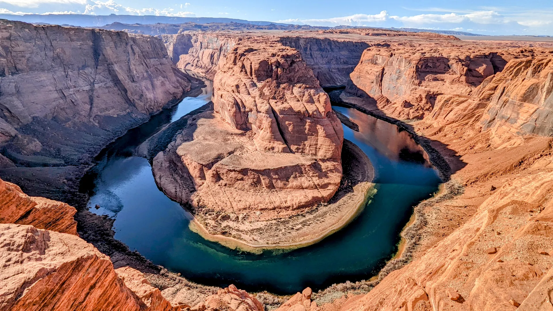
A near-perfect horseshoe-shaped bend where the Colorado River wraps almost entirely around a freestanding tower of Navajo sandstone, carved roughly 1,000 feet straight down into Glen Canyon near Page, Arizona. The overlook drops off with no railing at the edge, putting visitors face to face with a river that seems to have simply changed its mind about which direction to flow.
From the rim, Horseshoe Bend doesn't read as a river doing what rivers do. The Colorado curls through more than 270 degrees around a single butte of exposed sandstone, entering from one side of the frame and leaving from almost the same side it came in, as if it hit a wall of empty air and turned back rather than push through solid rock. It takes a short, sandy 1.5-mile round-trip walk from a parking area off U.S. Route 89 to reach the rim — no fence, no barrier, just a drop of about 1,000 feet from the overlook down to the water.
The bend exists because of a geological trick played out over millions of years. Around six million years ago, this part of the Colorado Plateau sat close to sea level, and the Colorado River meandered lazily across a nearly flat floodplain the way rivers do when they have nowhere in particular to be. Then the region began to lift — a slow, sustained uplift of the plateau that trapped the river in the loops it had already carved. Instead of straightening out as the ground rose beneath it, the river did the opposite: it cut straight down, preserving its old meandering path as a canyon instead of letting it wash away. The horseshoe shape isn't a coincidence of erosion; it's a fossil of where the river happened to be bending the moment the ground started rising.
The rock itself is older than the canyon by an enormous margin. The pale walls of Horseshoe Bend are Navajo Sandstone, the same formation that makes up the deepest layers of the Grand Canyon at this point in its course. It began as a fossilized erg — an ancient field of wind-blown desert dunes — roughly 190 million years ago, during the Jurassic period, long before there was a Colorado River to carve anything at all. The diagonal cross-bedding visible in the cliff faces is fossilized wind, frozen mid-motion.
Horseshoe Bend sits within Glen Canyon National Recreation Area, about 5 miles downstream from Glen Canyon Dam and Lake Powell, and the dam's presence changes what visitors actually see: the river below the overlook runs a cold, saturated green-blue, fed by water released from deep in the reservoir rather than the muddy red-brown the Colorado carried before the dam went in. That color, against orange sandstone a thousand feet below a cloudless desert sky, is the specific combination that turned a formation known mostly to river runners into one of the most photographed single frames in the American Southwest — now drawing more than two million visitors a year to stand at an unfenced edge and look straight down at a river bending back on itself.
Interesting facts
Is Horseshoe Bend part of the Grand Canyon?
Not officially - it sits within Glen Canyon National Recreation Area, just upstream of Grand Canyon National Park. But it is carved through the same Navajo Sandstone layer that forms the deepest canyon walls at this stretch of the Colorado River.
How much of a turn does the river actually make?
Roughly 270 degrees, more than three-quarters of a full circle, wrapped around a single freestanding butte of sandstone that the river never managed to cut through.
How far is the walk to see it?
About 1.5 miles round trip on a sandy trail from a parking area off U.S. Route 89, just southwest of Page, Arizona - no fence or barrier separates the trail from the drop.
Why is the water such an unusual green-blue?
Horseshoe Bend sits about 5 miles downstream of Glen Canyon Dam. The river here runs on cold, sediment-filtered water released from deep inside Lake Powell, instead of the muddy red-brown color the undammed Colorado used to carry.
How old is the rock the canyon is carved through?
The pale cliffs are Navajo Sandstone, a fossilized field of wind-blown desert dunes laid down about 190 million years ago in the Jurassic period, tens of millions of years before the Colorado River existed to carve anything.
How deep is the drop from the overlook?
About 1,000 feet. The rim sits roughly 4,200 feet above sea level, while the river below is close to 3,200 feet - a sheer vertical fall with no railing at the edge.
Why does the river bend almost all the way back on itself?
Around six million years ago the Colorado River meandered lazily across a nearly flat floodplain. When the Colorado Plateau began uplifting, the river stayed locked in its existing loops and simply cut straight down, freezing the meander in place as a canyon instead of letting it straighten out.
Safety information
Horseshoe Bend is open to visitors, but the overlook has exposed cliff edges, extreme desert heat, limited shade, and regulated parking access.
Why this guidance exists
Recommended actions
- Use the official parking area and do not park or stop along US Highway 89
- Stay on the designated trail and behind safety railings where present
- Do not approach unprotected cliff edges for photos
- Keep children close and supervise them constantly near the overlook
- Bring enough drinking water, light snacks
- Avoid visiting during the hottest part of the day in summer
- Wear sun protection, sunglasses, a hat, and sturdy walking shoes (no sandals!)
- Expect limited shade on the trail and at the overlook
- Check current weather, road, parking, and closure information before visiting
- Keep pets leashed, protect them from hot ground, and bring water for them
- Avoid visiting during thunderstorms, high winds, poor visibility, or icy conditions
- Respect the desert environment and pack out all trash
Sources
- https://www.nps.gov/glca/planyourvisit/horseshoe-bend.htm
- https://www.nps.gov/thingstodo/take-a-stroll-to-horseshoe-bend-overlook.htm
- https://www.nps.gov/glca/planyourvisit/safety.htm
- https://www.visitpageaz.com/places-to-go/horseshoe-bend/
- https://www.visitarizona.com/like-a-local/a-guide-to-visiting-horseshoe-bend-the-right-way