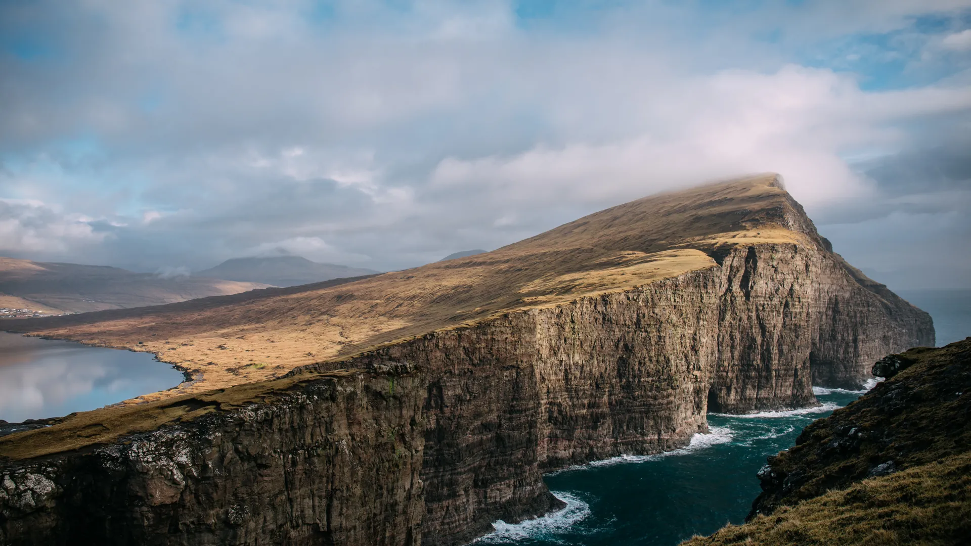
The largest lake in the Faroe Islands, sitting a modest 32 meters above sea level — yet from the cliff of Trælanípa on its eastern shore, perspective conspires to make it look like it hovers hundreds of meters above the Atlantic. The gentle slope of the shoreline lines up with the sheer drop of the sea cliffs behind it, collapsing two different distances into one impossible image.
Sørvágsvatn is not a large lake by any real measure — its surface floats a mere 32 meters above the ocean, an elevation you could climb in a few minutes on any staircase. And yet stand on the right patch of grass atop Trælanípa, the cliff on its eastern edge, and the lake performs a trick that defeats the eye every time: it appears to be suspended several hundred meters above the crashing Atlantic, an aquarium tilted into the sky.
The illusion works because of an accident of geometry rather than anything supernatural. The lake's near shore slopes gently down toward the cliff edge, while the cliff itself drops away in a nearly vertical wall to the sea below. Viewed from the correct angle, with the gradual slope of the water's edge visually merging into the sudden plummet of rock, the brain reads the whole scene as a single continuous incline — one long fall from lake surface to ocean, when in reality the two are separated by only a shoulder of grass and thirty-some meters of true elevation. Move a few steps in the wrong direction and the illusion collapses instantly; the lake sinks back into its ordinary self.
The name of the cliff carries its own weight. Trælanípa translates roughly to "Slave Cliff," a name tied to Viking-age accounts — likely more legend than confirmed history — that unwanted or disobedient slaves were pushed from its edge into the sea far below. Whatever truth survives in the story, the name has outlasted it, attached now to one of the most photographed viewpoints in the North Atlantic.
Getting there means a walk of an hour or so across open, treeless moorland from the village of Miðvágur, sheep scattered across the hillside, wind arriving without warning from any direction. Beyond Trælanípa the trail continues to Bøsdalafossur, where the lake's outflow does the one thing the illusion only pretends to: it actually falls, straight off the cliff edge into the ocean, no trick of perspective required. Between the two — the lake that seems to fly and the waterfall that genuinely does — Vágar Island offers a short course in exactly how much the eye can be persuaded to believe.
Safety information
The location is open to visitors, but access to the popular Trælanípa and Bøsdalafossur viewpoints requires payment and entry via the official route.
Why this guidance exists
Recommended actions
- Check the latest access rules and hiking fee before visiting
- Use only the official entrance and marked trail
- Do not approach cliff edges, especially in wind, fog, or wet conditions
- Wear waterproof clothing and proper hiking shoes
- Avoid visiting during strong wind, heavy rain, fog, or poor visibility
- Plan enough time for the hike and do not rely only on mobile signal
- Respect the land access rules and avoid damaging the natural environment
- For non Nordic or United Kingdom citizens health insurance must be obtained