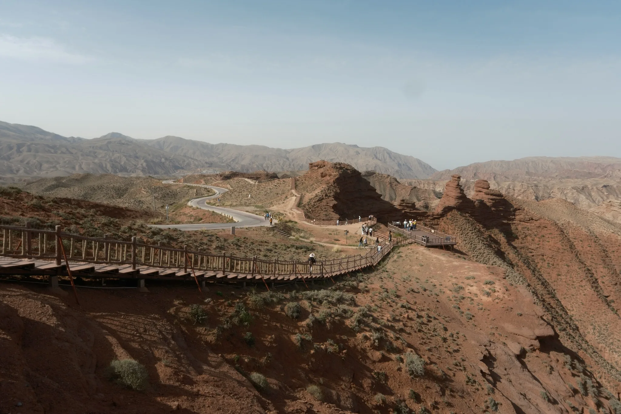
Layered bands of vivid red, orange, yellow, green, and blue sandstone eroded over 24 million years into dramatic ridges and towers — the most colorful mountains on Earth, a palette applied by time itself.
The Zhangye Danxia landform was once an ancient inland sea. Over tens of millions of years, sediment accumulated in horizontal layers — each colored differently by the chemistry of what it carried: iron oxide producing deep reds and burnt oranges, chlorite producing sage greens, carbonate producing white, and trace minerals creating purple, blue, and yellow tones. The sea dried. The Tibetan Plateau lifted. Erosion began its long, patient work. The result is a landscape that appears to have been painted on a scale that the human visual system processes with consistent astonishment.
The Zhangye Danxia National Geological Park covers approximately 500 square kilometers in Gansu Province, northwestern China — in the Hexi Corridor, the ancient route of the Silk Road. The formations visible at the main viewing areas have been eroding for approximately 24 million years. In that time, the horizontal sedimentary layers have been carved by water, wind, and freeze-thaw cycles into ridges, pinnacles, canyons, and rounded mounds, each one exposing the geology as a cross-section of time. A single ridge may show 10 or more distinct colored layers, each representing a different depositional period separated by millions of years.
The intensity of the colors is not static. After rainfall, the iron oxides in the red and orange layers saturate to a depth of color that cameras consistently fail to reproduce accurately — a particular vivid red that reads as unnatural until you have seen it in person, when it reads as more real than red has any right to be. At sunrise and sunset, low-angle light catches the faces of ridges at oblique angles that make each individual colored stripe legible. At midday in flat light, the palette is more muted and the formations read as geological evidence rather than visual experience. The same formation presents four different versions of itself across a single day.
UNESCO designated Zhangye Danxia a World Heritage Site in 2010 as part of the broader nomination of China's Danxia landforms — a geological category specific to this type of red-bed erosional landscape. Similar formations exist in other provinces, but Zhangye is distinguished by the variety and intensity of its colors, driven by unusual mineral diversity in the original sediment and the Hexi Corridor's arid climate, which limits biological coverage and preserves color saturation that wetter environments would suppress.
The park is organized around shuttle-bus-served viewing platforms; the largest and most photographed section is at Bingou. From the platforms, the formations stretch to the horizon in every direction, ridge lines and peaks layered in color bands whose scale the brain consistently misjudges — what appears to be a low ridge at eye level turns out, when a person or vehicle provides scale, to be 50 meters tall. The Earth spent 24 million years making this. It is possible to stand on the viewing platform, see the evidence clearly, understand the geology completely, and still be unable to fully believe it.
Interesting facts
Why is this landform named after a mountain nowhere near Gansu?
The term comes from Mount Danxia in Guangdong province, over 2,500 kilometers to the southeast, where geologists first classified this type of red sedimentary rock in the 1920s and 1930s. By 1939, geologist Chen Guoda had formalized "Danxia landform" as the scientific name for any red-bed erosion of this kind, wherever it occurs. Danxia itself is an old Chinese poetic phrase for the rosy clouds of sunrise and sunset -- a name for a color in the sky, borrowed for stone.
Why do the colors run in stripes instead of solid blocks?
The layers were deposited flat, one on top of another, in an ancient inland basin over millions of years. When the Indian Plate collided with Eurasia roughly 55 million years ago and pushed up the Tibetan Plateau, the once-horizontal strata were tilted and folded. Erosion later cut across those tilted layers at an angle, exposing each band of color like a knife cut through a layer cake.
Why does one hillside show ten different colors at once?
Each color comes from a different mineral that happened to be present when that specific layer of sediment was deposited. Iron oxide produces the dominant reds and oranges, iron sulfide creates a metallic yellow, chlorite and iron-silicate clays turn layers green, and trace minerals add purple and blue. A single ridge can expose ten or more of these layers, each one a snapshot of a different chemical moment separated by millions of years.
Why do the colors look far more saturated right after it rains?
Dry sandstone scatters light unevenly and looks comparatively muted. A thin film of rainwater temporarily fills the surface pores and smooths reflection across the mineral grains, boosting color contrast until the rock dries out again. That is why the recommended visiting window, July through September, leans on the region's brief rainy season rather than its clearest skies.
Is Zhangye Danxia officially a UNESCO World Heritage Site?
Not quite -- a common mix-up. The 2010 "China Danxia" World Heritage inscription covers six Danxia landforms in southeastern China, including the original Mount Danxia in Guangdong, and none of them are in Gansu. Zhangye's park received a different UNESCO recognition instead, becoming a UNESCO Global Geopark in 2020.
Why did early photos of the mountains get accused of being fake?
Telephoto lenses compress distance, flattening the ridges into what looks like a painted backdrop, and the natural color saturation is already extreme for a landscape. When images circulated online in the early 2010s, that combination convinced many viewers the photos had been digitally altered, even though the colors are close to what a visitor sees in person under the right light.
Why haven't plants and moss covered up the colors, the way they would at a similar rock formation somewhere wetter?
Zhangye sits in the Hexi Corridor, a historically arid stretch of the ancient Silk Road, where low rainfall limits vegetation and biological growth on exposed rock. In a wetter climate, moss and lichen would gradually mute or hide the mineral coloring; here, the dry air keeps the surface bare enough for the original color bands to stay visible.
Why do the ridges look smaller than they actually are?
Without a reference object, the eye has nothing to judge scale against on a landscape made of repeating color bands. What looks like a modest slope from the viewing platforms often turns out to be 50 meters or more in height once a person, vehicle, or shuttle bus appears somewhere on it for scale.
Safety information
Safety information is not available yet.
Before visiting this place, check current safety guidance, access rules, local restrictions, and official updates on other trusted websites. Our editorial team does not have verified safety information for this location at the moment; it will appear here later.